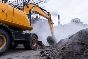
Underground or subsurface utilities are infrastructures installed below ground. They include data cables, electric lines, gas/oil pipelines, telecommunication cables, and sewer/water pipelines. Most older utility lines were installed above the ground but are often reinstalled, as are new lines, underground for added safety and aesthetics.
Construction business excavations that damage underground utilities average 530,000 each year. “Contractors no longer accept utility strikes as part of the job,” says Hexagon’s Simon Pedley. “No strike is acceptable.” The market for construction business utility detection is expected to reach $1.7 billion by 2023.
5 Construction Business Utility Locator Challenges
Locators are the technicians tasked with preventing utility strikes during construction and excavation. A recent survey revealed locators’ challenges include:
- Arriving on site where there is no white-lining
- Difficulty meeting short lead times
- High demand/backed-up jobs
- High turnover
- Need for continuing education/training
The process for locating underground cables, lines, and pipelines uses electromagnetic locators (EML) and ground-penetrating radar (GPR). EMLs are unable to detect non-conductive lines, including concrete, clay/plastic pipes, and fiber optic cables. GPRs can detect non-conductive materials by transmitting a signal and receiving an echo. The problem with GPRs is they find everything underground. The technology requires a post-scanning professional analysis.
Contractors are frustrated when faced with old, out-of-date utility maps. They open trenches and vacuum potholes, which are inefficient, expensive, and often a waste of time. Uniting EML and GPR technologies makes sense. Pendley said, “I always suggest using both technologies. You want to have both EML and GPR on hand to give yourself the best chance of understanding what’s under the ground.”
You should be able to find construction business data analytics without digging too deep. The data we’ll provide you is presorted and ready to use. It’s specific to your company’s requirements for business development.
Let our marketing professionals explain which tools will work best for you. For example, Permit Insight Mapping provides an at-a-glance visual of opportunities in your area. It also tells you which contractors have the most activity.
To get your free weekly edition, contact Construction Monitor.


I found it interesting when you said that post-scanning is required when you need to find everything underground using GPR. This actually reminds me of the use of excavation equipment like a skid steer box on areas that may be filled with underground cables. Maybe, it will be best to do proper planning before the use of any excavation equipment.