Think about how often and the variety of ways we use cellphone cameras. Camera information enhances personal and professional activities almost daily.
Digital Imagery for Construction Industry Worksites
If you’re using free satellite imagery to monitor project sites… Well, you get what you pay for. The technology is often outdated and unreliable. Digital imagery technology is becoming critical to providing and managing construction industry solutions. The possibilities are exciting and seemingly endless.
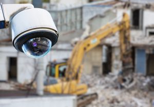
Construction sites are chock-full of high-value equipment and materials. Most project sites are deserted at night and poorly lit; this is an invitation to thieves and vandals. Increasingly, jobsite surveillance is needed, and cameras are the visual technology we use.
Artificial Intelligence (AI) + Aerial Imagery (AI)
Aerial imagery is evolving, and construction industry contractors and stakeholders can monitor a project site without roadtrips. At its most basic, cameras offer better project safety and save time for managers.
Today, additional imagery tools can provide remote measurements. You can gauge length and width, area and radius offsite. Object detection and image segmentation are artificial intelligence aerial imagery tools used by engineers and land surveying professionals.
Five ways aerial imagery adds value to construction industry projects are:
- Client care – The value to take clients on a virtual tour of their projects is priceless. Some digital images provide site “immersion” and 3D models.
- Historical data – How has the topography changed over time and what seasonal disruptions are likely?
- Natural disasters – Monitor the effects of fires, floods, hurricanes, tornadoes, and other disasters in real-time for a knowledge-based response. You can also appraise the level of damage and prioritize areas that need restoration/repair.
- Positioning – At-a-glance imagery can reveal bottlenecks and work stoppages. You can re-position workers and when supplies and materials are incoming, see the best locations for delivery.
- Verification – If you’re mid-review of documentation and there’s a question or concern, real-time images and/or historical photodata are readily available. Before-and-after incidents or accidents are captured for later evaluation.
Construction Monitor building permit data can provide a real-time picture of business leads in your area. Don’t miss an opportunity: Contact Construction Monitor.

